Enhancing Crop Yields with Drone Field Mapping
In recent years, technology has revolutionized the agriculture industry, offering farmers new ways to boost crop production. One such advancement is the use of drone field mapping, a technique that is proving invaluable in enhancing crop yields. This blog explores how drones are reshaping modern farming practices and why they’re becoming an essential tool for farmers aiming to optimize their harvests.
Understanding Drone Field Mapping
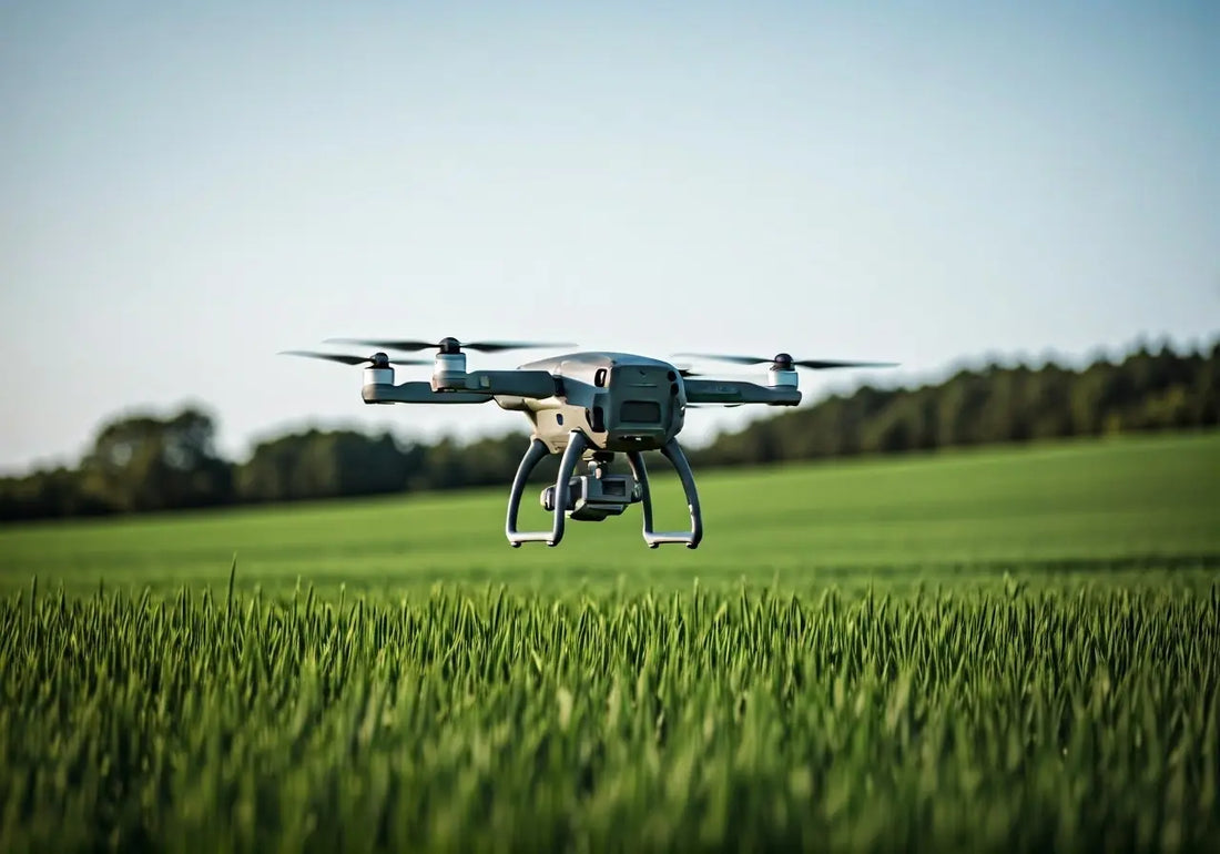
Drone field mapping involves using drones equipped with cameras and sensors to capture aerial images of farmland. These images provide detailed information about the condition of crops, soil, and the overall environment. This technology allows farmers to monitor the health of their fields with precision and ease. It’s akin to giving farmers a bird’s-eye view, empowering them to detect subtle changes in their crops, from signs of disease to areas of drought stress. With the help of sophisticated software, these drones transform raw data into actionable insights, which ultimately assist farmers in managing their lands more efficiently.
The technology behind drone field mapping is as impressive as its application. Each drone flight is calibrated to capture data in layers, such as visual and multispectral imagery, which enables farmers to see beyond the visible spectrum. This kind of imaging helps identify problems in crop growth before they manifest at ground level, allowing for preemptive care. Moreover, advanced drones are equipped with GPS for high-precision mapping, ensuring that each flight precisely follows a planned route, gathering consistent data each time. Discover how this technology is part of a broader revolution in agriculture that promises enhanced management of resources and increased crop efficiency.
Benefits of Drone Field Mapping for Farmers
Drone field mapping offers numerous advantages, such as significant time savings, cost-effectiveness, and increased accuracy in monitoring crops. By quickly covering large areas, drones can help identify issues such as pest infestations or water stress, enabling farmers to address them promptly. Unlike traditional methods that may involve walking fields or relying on satellite data, drones provide real-time insights that allow for immediate action. This not only saves precious time but also helps optimize resources like water, fertilizers, and pesticides by ensuring they are only used where absolutely necessary.
One of the most notable benefits of drone field mapping is its ability to enhance precision agriculture. By reducing the guesswork involved in farming, drones enable more strategic decisions, leading to better resource management and potentially reducing costs. For instance, by utilizing drones, farmers can detect early signs of diseases or pest outbreaks, often invisible to the naked eye from the ground. This detection is crucial as it allows farmers to intervene early, minimizing damage and safeguarding yields. Furthermore, customized treatment plans can be developed with accurate data collected by drones, ensuring that interventions are as effective as possible while reducing environmental impact.
How Drone Field Mapping Improves Crop Yields
By providing farmers with detailed data, drone field mapping helps optimize farming practices. Farmers can use this information to apply fertilizers and pesticides more efficiently, leading to improved crop health and enhanced yields. The ability to pinpoint specific areas in need of attention allows for targeted interventions, reducing waste and improving productivity. Such precision in management ensures that crops receive exactly what they need to thrive, which directly translates into larger and healthier yields. By embracing this transformative technology, farmers can move towards more sustainable and efficient practices that conserve resources and boost profitability.
Drone field mapping contributes to yield improvement by offering farmers a clearer picture of what their fields need. For instance, these drones can calculate the exact amount of fertilizer required for each part of the field, ensuring that the crops’ nutritional needs are met without over-application, which can harm the soil. In terms of irrigation, drones help monitor soil moisture levels across different zones of a farm, which allows for the precise allocation of water only to areas that require it. This reduces water waste and enhances the health of the plants, culminating in better growth and higher yields.
Challenges and Considerations
While drone field mapping offers many benefits, there are challenges as well. Factors such as the initial investment cost, the need for technical expertise, and regulations surrounding drone use can pose obstacles for some farmers. The upfront cost of purchasing high-quality drones and the software necessary for analyzing the data can be a significant barrier, especially for smaller farms. Training is also essential, as operating drones and interpreting the data require a specific skill set. Finally, understanding and complying with local regulations regarding drone flights is crucial to avoiding legal issues.
The complexity of drone technology also means that farmers need access to reliable tech support and educational resources to make the most of these tools. This is where partnering with tech companies or agricultural extension services can be beneficial, providing the necessary expertise and support. Additionally, as regulations vary widely by region, staying informed about the regulatory landscape in one’s area is essential for compliance.
Real-World Applications and Success Stories
Many farmers worldwide have already seen positive results from incorporating drone technology into their farming practices. Success stories highlight how drones have led to increased efficiency and profitability. Real-world examples provide insight into the potential of drone field mapping to transform agriculture. For instance, a vineyard in France used drone technology to map its fields and identify microclimates within the vineyard that were not visible from the ground. This allowed for targeted interventions that resulted in a notable improvement in grape quality and yield.
In India, rice farmers have adopted drones to help monitor the progress of their crops. The drones’ detailed imagery allowed the farmers to detect areas of pest infestation early and address water management issues more effectively, leading to an increase in yield production. Similarly, in the United States, a corn farm adopted drones to manage fertilizer application better, resulting in savings on inputs and an increase in productivity. As technology continues to evolve, these innovative integrations of drones into agriculture serve as powerful examples of how tech-savvy farmers can enhance their operations and profit margins sustainably.
The Future of Farming with Drone Technology
Drone field mapping is more than just a technological fad; it’s a practical and innovative solution that addresses some of the traditional challenges of agriculture. By offering precise data and insights, drones empower farmers to make informed decisions that can lead to healthier crops and higher yields. As technology continues to advance, the integration of drones in agriculture will undoubtedly become even more significant, paving the way for a future where farming is both efficient and sustainable.